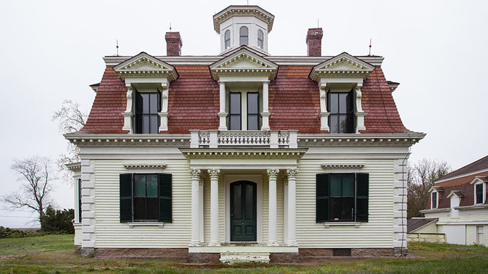
Photo: Captain Edward Penniman House, ca. 1867, Fort Hill and Governor Prence Roads, Eastham, MA. Listed on the National Register of Historic Places in 1976. Photographed by User:Kenneth C. Zirkel (own work), 2012, [cc-by-3.0], via Wikimedia Commons, accessed April, 2021.
Communities and Landscape [1]
Cape Cod is a narrow curved spit of sand jutting into the Atlantic Ocean from the southeastern shore of Massachusetts. Shaped like an upheld crooked arm, the peninsula tapers to a hook at its outermost point with Cape Cod Bay on the west and south and the Atlantic Ocean on east and north. The landscape of the Lower or Outer Cape, the sickle-shaped section beyond the Upper or Inner Cape, is characterized by rolling terrain dotted with scrubby oak and pine woods, salt marshes, kettle ponds, and bogs. Sandy beaches emerge as extensive dunes along the perimeter and high bluffs on the ocean side. Secluded pond settings and stunning open views of dunes and ocean create a varied and sunlit landscape that has attracted settlers and recreationalists for several centuries. The shifting sands and interweaving of land and water create a dynamic and ever-changing landscape. The furthest extent of the Outer Cape is comprised of four towns — Eastham, Wellfleet, Truro, and Provincetown. Each community possesses a unique character within the general features of this distinctive region whose identity as a scenic destination was reinforced by the creation of the Cape Cod National Seashore in 1961.
Eastham is the first town encountered when heading to the lower tip of Cape Cod after turning at the "elbow" in Orleans. Initially a large tract of land incorporated in 1651, Eastham figured in Colonial history as the site of the first encounter between the Pilgrims and Native Americans in 1620. The town's early economy through the mid-twentieth century was based in agriculture and fishing. A large Methodist summer camp meeting started in the northwest part of town in 1830. A series of light stations and lifesaving stations along Nauset Beach served seagoing travelers. Eastham has remained the most architecturally and socially traditional town on the Outer Cape and has the fewest number of mid-twentieth-century Modern houses of the four communities. The National Park Service's Cape Cod NS Salt Pond Visitor Center opened in 1966 in Eastham.
Wellfleet separated from Eastham in 1763 as a new town. Situated between Eastham to the south and Truro to the north, it occupies the widest part of the outer peninsula. The Cape Cod Bay side of Wellfleet consists of a remote, undeveloped, and forested area comprised of four former islands created by the network of tidal rivers flowing between the Cape Cod Bay to the west and Wellfleet Harbor to the south and east. A vibrant fishing community developed on Wellfleet Harbor concentrated at the town center and port located on west side facing the Bay. Early whaling, shellfish gathering, and mackerel fishing dominated residents' livelihood in the eighteenth and nineteenth centuries. As seafaring activities declined, construction of the Chequessett Inn on the abandoned Mercantile Wharf about 1900 initiated the town's tourist industry. In the early and mid-twentieth century Wellfleet attracted a summer colony of artists, architects, writers, and intellectuals, creating the second highest concentration of art galleries on the Outer Cape, after Provincetown. Pioneering interest in mid-twentieth-century Modern architecture on the Cape occurred in Wellfleet, and numerous houses are clustered around the town's scenic ponds, hollows, high bluffs, and Bound Brook Island.
Located beyond Wellfleet in a tapering section of the peninsula, Truro incorporated in 1709 as a separate town from Eastham (then including Wellfleet). Early fishing, whaling, and shipbuilding stopped after the East Harbor port at Pilgrim Lake and the Pamet River harbor were destroyed by infilling sand in the 1850s and 1860s. The opening of Highland House for summer visitors in 1850 and the completion of the Cape Cod Central Railroad connections between the lower Cape and Boston in 1873 signaled a growing summer community of cottages and a dispersed settlement with a small town center area. Expansive Pilgrim Lake and an immense area of dunes, beaches, and shoreline bluffs along the Truro Highlands contrast with the rolling hills and protected Pamet River valley. Truro has attracted many artists, writers, and mid-twentieth-century Modern house architects, homeowners, and enthusiasts to its secluded landscape.
Originally recognized as the Provincelands in 1692, Provincetown established its first government in 1714. Whaling and fishing out of the port located on the protected south side of the hook at the end of the Cape Cod peninsula supported its residents in the eighteenth and nineteenth centuries. In the 1890s, Provincetown boomed with locals, Portuguese immigrants, writers and artists, and a growing summer community. By the early twentieth century, the artistic and literary community comprising the Provincetown art colony had achieved an international reputation. The creative and lively community continued to expand and was tempered around the middle of the century by a burgeoning tourist industry that came in large part to see and be part of the artistic energy. Provincetown's landscape consists of the densely built town center and surrounding open dunes. As a result, few mid-twentieth-century Modern houses were built in the town, and it served as a vortex of creative energy and commercial galleries for the Outer Cape.
- Virginia H. Adams, Senior Architectural Historian, Jenny Fields Scofield, AICP, Architectural Historian, Laura Kline, Architectural Historian, Quinn Stuart, Architectural Historian, and Blake McDonald, Assistant Architectural Historian, PAL (The Public Archaeology Laboratory, Inc., Mid-Twentieth-Century Modern Residential Architecture on Outer Cape Cod, 1929-1979, Massachusetts, Multiple Property nomination, 2011, National Park Service, National Register of Historic Places, Washington, D.C.